Technical innovation continues to rapidly and profoundly impact the practice of architecture. Here is one example: We can now perform a three dimensional laser scan of any built environment, rapidly collecting the locations of millions of points in space, creating a digital file housing a massive bundle of data known as a 'point cloud'. This point cloud can be 'read' by the three dimensional modeling software that plays a vital role in the majority of my architectural projects. The points are forensically accurate; each individual point is located with absolute precision within a tolerance of fractions of a millimeter.
In the example shown here, we gathered all the data for multiple buildings, including the surrounding streetscape and building interiors - hundreds of thousands of cubic meters of space - in a single day. Manual methods of documenting existing conditions like this with any level of similar completeness would involve weeks of work.
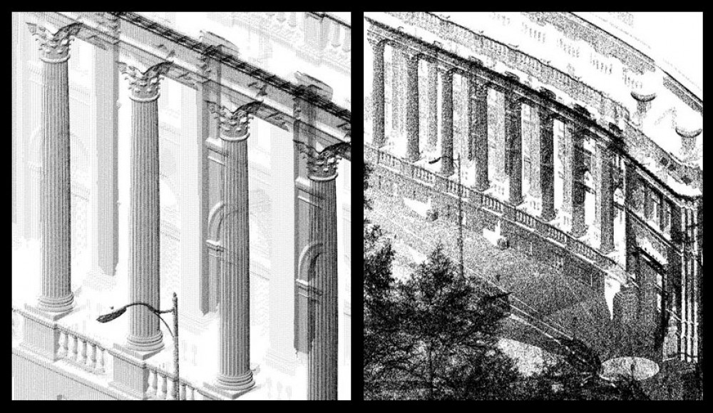
More significant than the speed is the completeness, accuracy, and and detail. Note in this enlarged image how the leaves on the column capitals, the fluting of the columns, and even the entasis (the nuanced swelling of the column) is vividly captured. You can actually see the grout joints in the masonry.
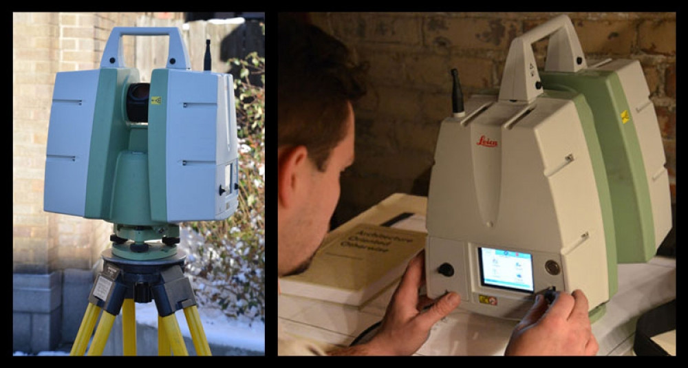
The applications for this technology will be vast, ranging from archeology to the military (the scanner, shown to the right, does not rely on visible light - it can work in total darkness). What it means to me as an architect is that I can rapidly establish an accurate and comprehensive understanding of existing conditions, regardless of their scope or complexity. It empowers me to deliver design work with confidence in the knowledge that I have a complete understanding of the physical context of the project. Architectural design quality, both artistically and technically, has always been dependent on, among many other things, having a solid understanding of the conditions we are working in and with.
The laser is positioned across the site, around and into the buildings I am working with, and at the end of the day, is taken to the studio to download all that data (in this case, over sixty gigabytes of information). I can immediately go to work with the data, which my three dimensional modeling software will read, so I can literally work inside this virtual world. Both clients and contractors love being able to see so clearly what is happening with their project.

Author: Sam Rodell
Sam has practiced as an award winning architect for forty years, and has also built many of his clients' projects. He is licensed throughout most of the western USA and Canada, and is certified by the National Council of Architectural Registration Boards (NCARB) which expedites registration in other states and provinces. He was the first Certified Passive House Consultant architect in eastern Washington and northern Idaho.